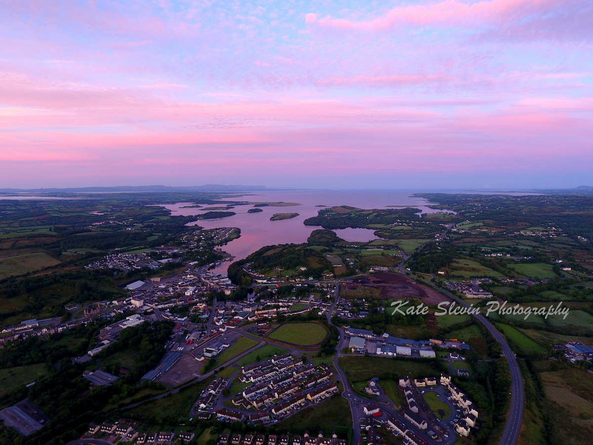
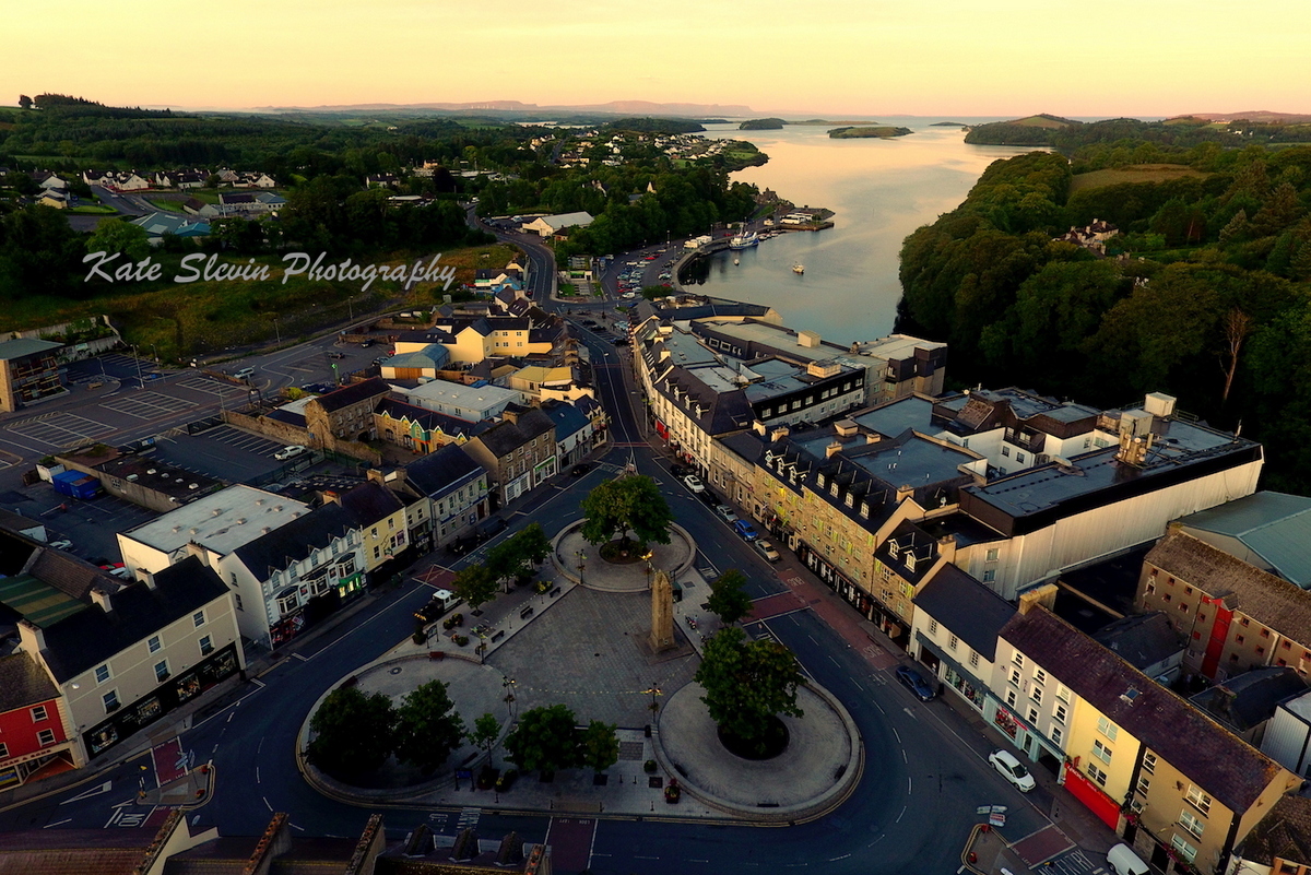
Donegal Town County Donegal Ireland. Donegal is a town at the mouth of the River Eske, Co Donegal. It was originally built in the 15th century, Donegal Castle has later additions from the Jacobean period. The Four Masters Memorial obelisk honours 4 scribes from the nearby Franciscan friary, now in ruins. Don't miss a visit if you are in the area.
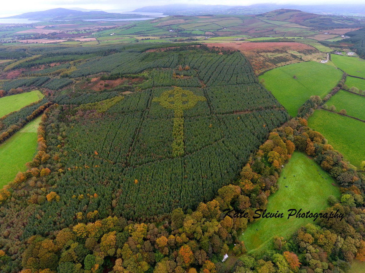
Emery Celtic Cross Bogay Hill Newtowncunningham County Donegal Ireland. This cross is approximately 125 by 70 metres, and located on the side of Bogay Hill just outside Newtown Cunningham at the northern end of the Lagan Valley. It was planted by local forester Liam Emery. He expertly planted 2 different species of pine trees, with some in the shape of this giant Celtic Cross roughly 11 years ago in these woods of Donegal. The outer trees are evergreen and don’t drop their needles during Autumn but the trees used for the actual cross design are not evergreen and turn this golden colour right before they drop their needles for the cold seasons ahead and is particularly visible now due to the seasonal weather. Sadly, Liam passed away 7 years ago and never got to witness his stunning creation grow. At Bogay Hill, Killea, near Newtown Cunningham, Co Donegal.
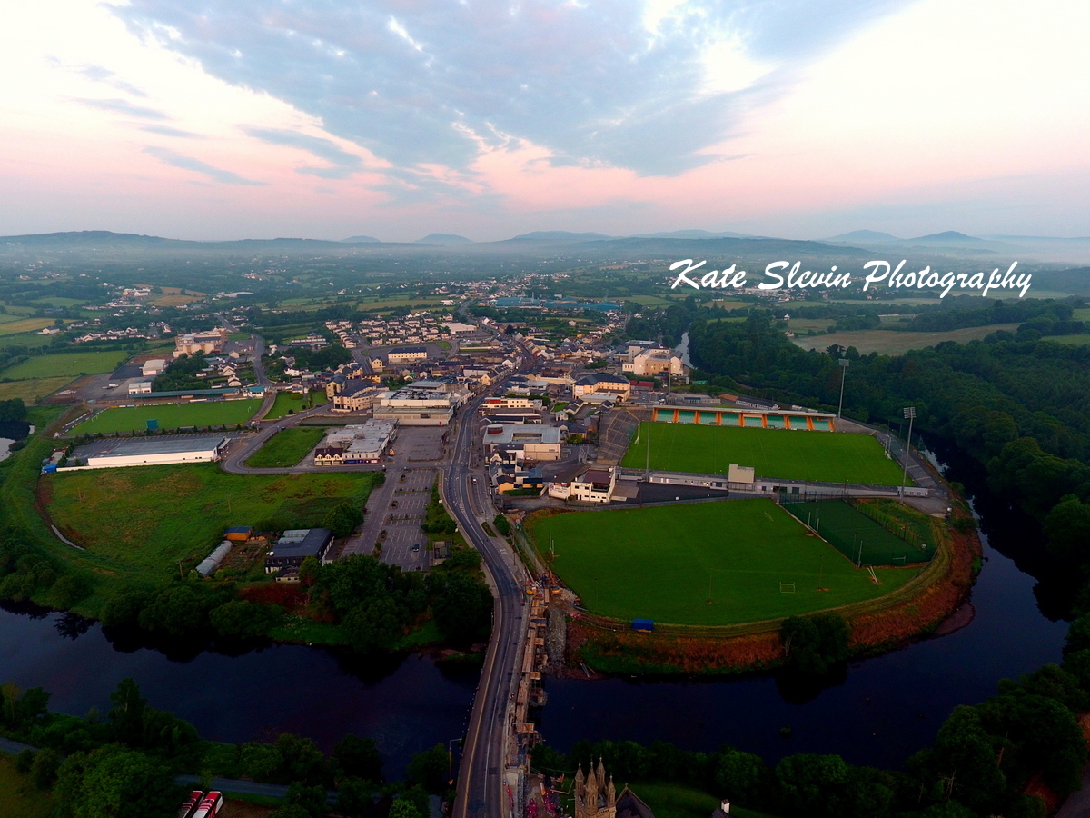
Ballybofey County Donegal Ireland.
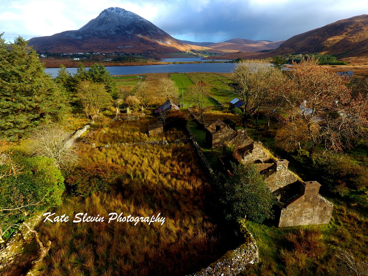
Glentornan, Dunlewey, County Donegal Ireland. "At the End of the Road" Glentornan is nestled on the shore of Dunlewey Lough overlooking the majestic Mount Errigal. Its at the end of the road and hidden away amongst the trees. This little village consisted of around 10 homes, about 50 people on average lived here between 1841 and 1911 when it was left almost totally abandoned. According to some locals, Glentornan’s families either emigrated or moved to be with their children who built new homes on the opposite side of Dunlewey Lough. Don’t miss this spectacular area for walks and hikes.
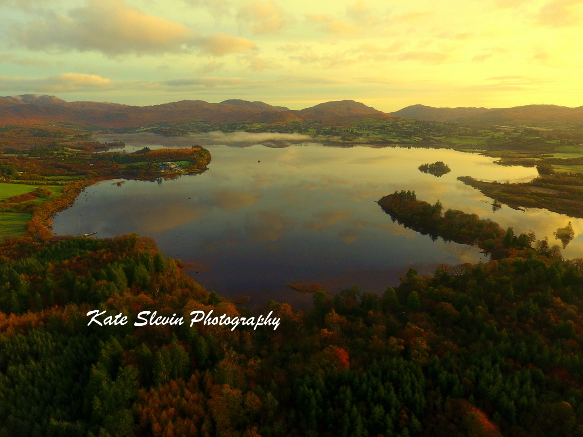
Lough Eske County Donegal Ireland. This lake lies to the northeast of Donegal Town, to which it is connected by the River Eske. The lake is about 900 acres (3.6 km2) in size and is surrounded to the north, east and west by the Bluestack Mountains.
Glenveagh National Park County Donegal Ireland. The Glenveagh Visitor Centre is located on the northern end of Lough Veagh, near the edge of the National Park. Its award-winning design incorporates a living heather roof mimicking the surrounding landscape causing minimum disturbance. Lough Veagh measures about 6 km (3.7 mi) long and 1 km (0.6 mi) wide and lies in the narrow Glenveagh valley surrounded by the Derryveagh and Glendowan Mountains. Steep granite cliffs rise on both sides of the lake to heights of about 300 m (1,000 ft). The lake has numerous small islands at its northern end. The 16,000 hectares of Glenveagh includes most of the Derryveagh Mountains, the Poisoned Glen and part of Errigal Mountain and is a beautiful place to walk the hills and follow trails.
Fintown Lough Finn Lough Muck Aghla Mountain County Donegal Ireland. A young giant, called Feargamhain and his three hunting dogs were attacked by a wild boar, while out in the mountains. The boar killed all three dogs. The young giant bravely defended himself, retreating all the while down the steep slopes of Aghla Mountain until they reached the eastern bank of Lough Finn. The boar was proving too able for the young giant who now called for help from his sister, Finngeal. By the time she got to the lake her brother and the beast were near their end. Owing to the echoes of the mountains she mistook the side of the lake from where the shouts came. She got to the other side of the lake, but the calls seemed to come from the side she just left. After much crossing and searching she finally found her brother in a mass of torn flesh and the wild boar also dead on the ground beside him. Exhausted in her efforts to help her brother and anguished in mind at being too late to help him she sank down and died. Hence the name Lough Finn. Nowadays there are no wild boars in Fintown apart from one! The steaming beast huffing along the shores of Lough Finn in the summer. Fintown Railway is Donegal’s only operational narrow gauge railway. (Pilleadh An Muc Dubh, "The return of the Wild Boar")
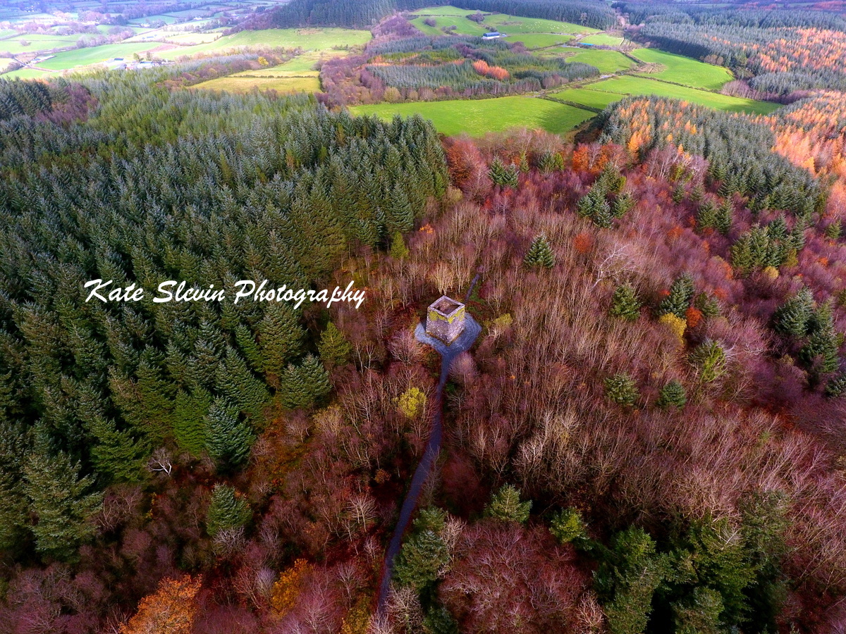
Steeple Tower Mullaghagarry Stranorlar County Donegal Ireland. A great walk taking in the views from the Steeple Tower on top of Meenavally Hill (219m). The woodland trees changing to their autumn colours.
Donegal Town County Donegal Ireland. it was originally built in the 15th century, Donegal Castle has later additions from the Jacobean period. The Four Masters Memorial obelisk honours 4 scribes from the nearby Franciscan friary, now in ruins.
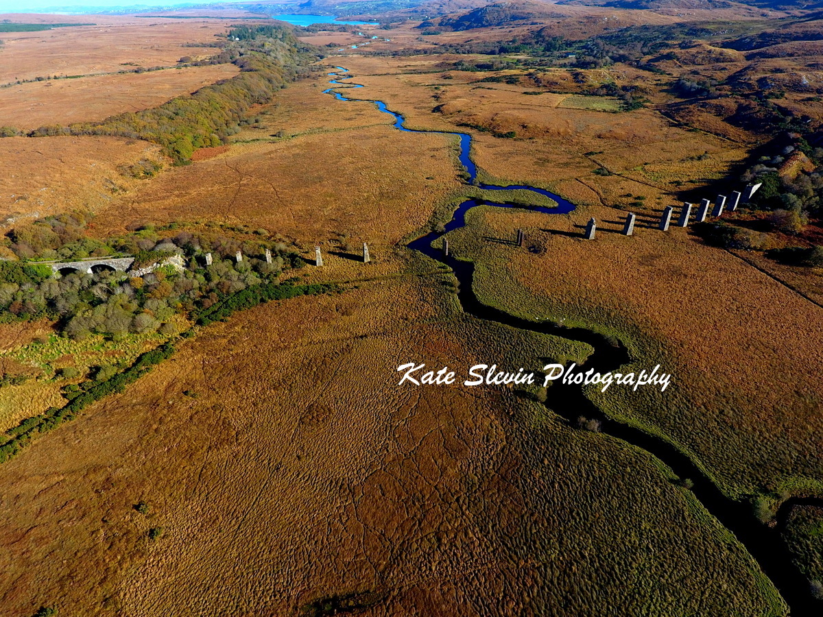
Owencarrow Viaduct Railway Creeslough County Donegal Ireland
Lough Eske County Donegal Ireland. Lough Eske also known as "Lake of the Fish" is a small lake outside Donegal Town, to which it is connected by the River Eske. The lake is about 900 acres (3.6 km2) in size and is surrounded to the north, east and west by the Bluestack Mountains. by the River Eske. The lake is about 900 acres (3.6 km2) in size and is surrounded to the north, east and west by the Bluestack Mountains.
Glenveagh National Park County Donegal Ireland. This park covers 170 square kilometres of hillside above Glenveagh Castle on the shore of Lough Veagh (Loch Ghleann Bheatha), 20 km from Gweedore in County Donegal. The network of mainly informal gardens displays a multitude of exotic and delicate plants from as far afield as Chile, Madeira and Tasmania, all sheltered by windbreaks of pine trees and ornamental rhododendrons.
Lough Eske County Donegal Ireland
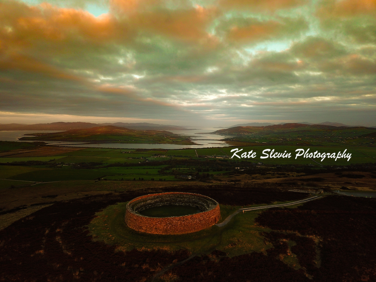
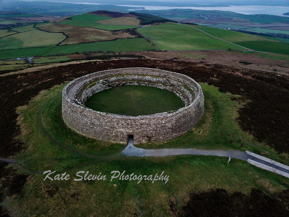
Grianan an Aileach Inishowen County Donegal Ireland. The Stone Fort of Grianán of Aileach is built on Greenan Mountain (244m above sea level) at Inishowen. The view from Aileach is breathtaking. At least five counties lie stretched before you, offering a fantastic view of the full expanse of Lough Swilly and Lough Foyle and the mountains and hills of Donegal on the horizon. The fort dates back to about 1700 BC. It is linked to the Tuatha de Danann who invaded Ireland before the Celts and built stone forts on top of strategic hills. They worshipped Dagda (the Good God) and he too is associated with the origins of Aileach. It was he who ordered the building of a stone fort to act as a burial monument to his dead son.
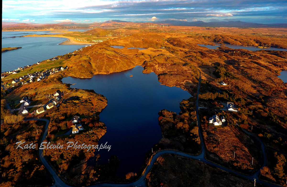
Portnoo Lake Portnoo County Donegal Ireland
Grianan an Aileach Inishowen County Donegal Ireland.
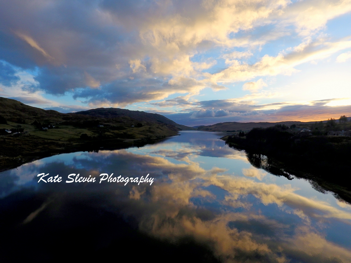
Barnesmore County Donegal Ireland
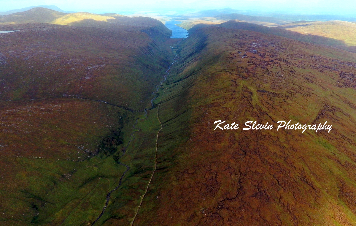
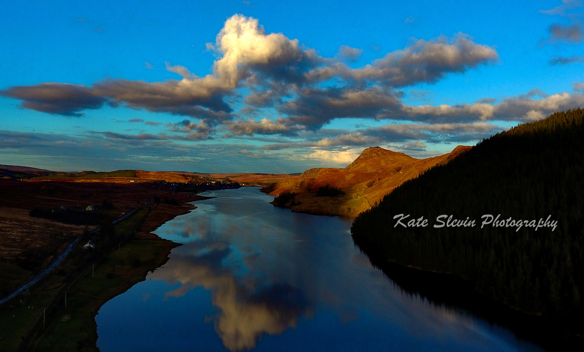
Lough Finn Fintown County Donegal Ireland. Lough Finn is approximately 5km long and almost a kilometer wide and sits below the mountains of Aghla (589m high) and Screig. The village of Fintown or Baile na Finne which means "Townland of Finn" is named after a figure from Irish mythology, Finngeal who it is said drowned in the lough trying to save her brother Feargamhain. The main attraction is an Mhuc Dhubh, the Fintown Railway, and Donegal's only operational narrow gauge railway, which takes visitors on a run along the length of Lough Finn and back. You can see the Railway Track between the Road and the Lake.
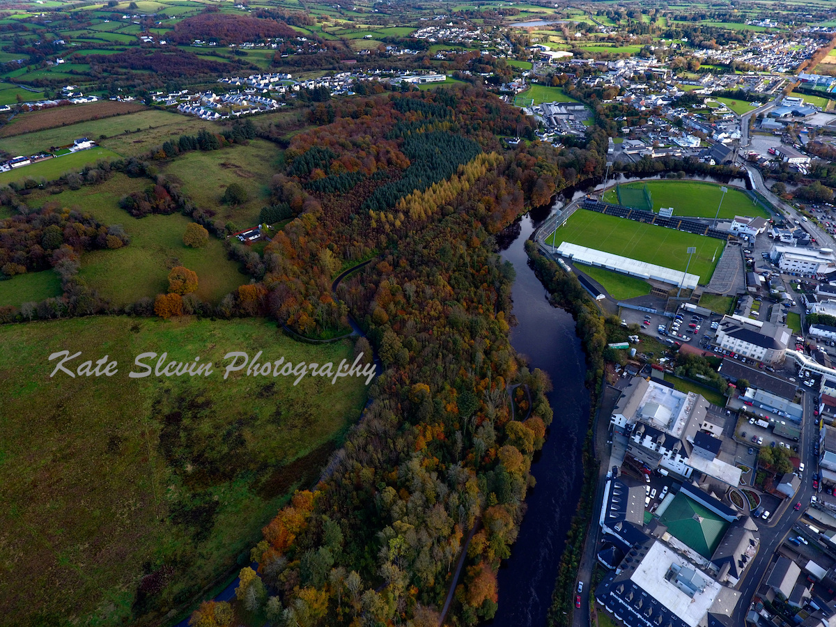
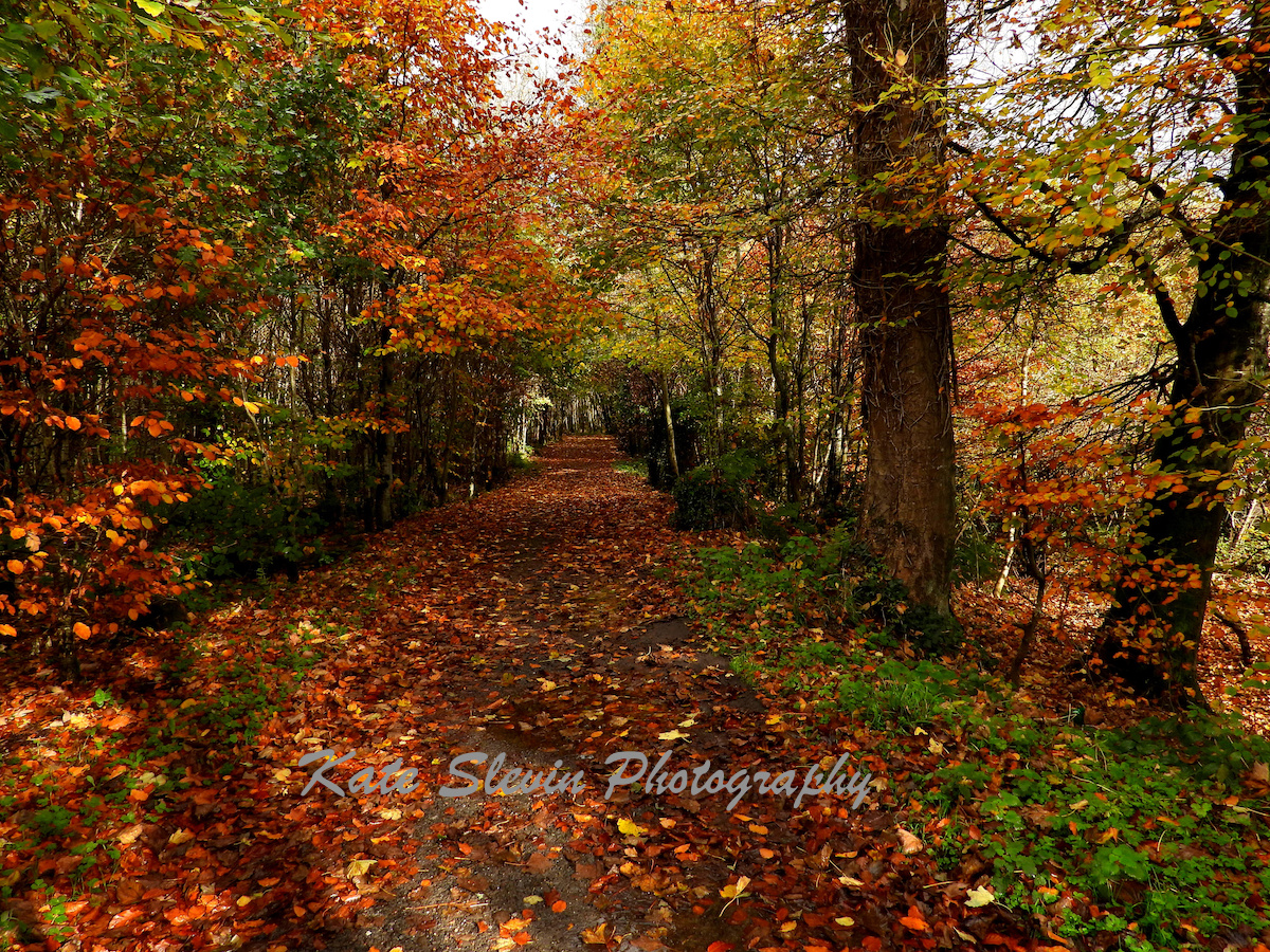
Drumboe Woods Stranorlar County Donegal Ireland. At anytime of the year, this small wood provides several very pleasant hour long rambles. In Drumboe, you can view displays of bluebells in spring, watch the leaf colour change in autumn, enjoy an early morning stroll in summer or the winter sun stream through the bare branches.
Drumboe Woods Stranorlar County Donegal Ireland.
Mamore County Donegal Ireland. Situated a little east of the the northern side of the Mamore Gap, a spectacular and scenic pass through the Urris Hills, and part of the route known as the Inishowen 100.
Lough Eske County Donegal Ireland. Harveys Point Hotel enjoys this magical location in the middle of the Bluestack Mountains, on the edge of Lough Eske.
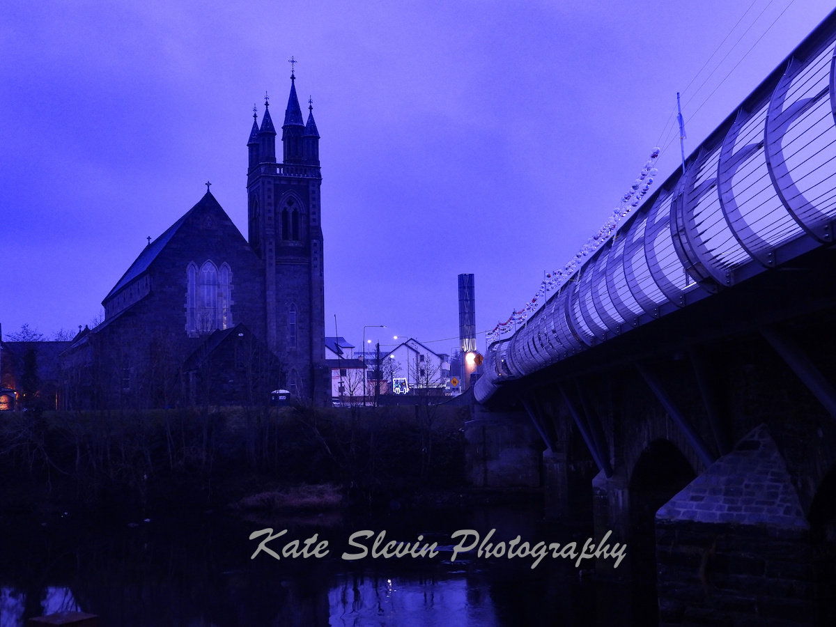
Footbridge Ballybofey Stranorlar County Donegal Ireland. Bridge over the River Finn, with a magical Women's Little Christmas Exhibition of Baubles.
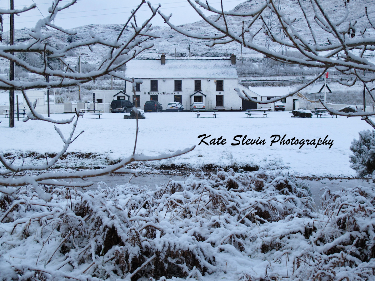
Biddys O'Barnes Public House, Ardnawark, Barnesmore County Donegal Ireland. Always beautiful but even more beautiful with a a 'dusting' of snow.

